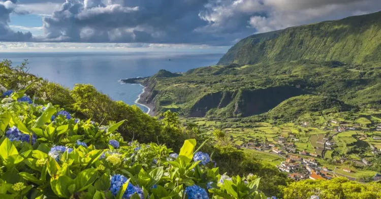
I'll admit it upfront: I'm from Madeira, and we like to think we invented Atlantic hiking. Then you step off the plane in the Azores, watch a cloud swallow a volcano before breakfast, and the rivalry gets quietly filed away. Hiking in the Azores means nine separate islands, spread across 600km of ocean, each with its own crater lakes, coastal shelves and steaming valleys. There's nothing else like it in Europe.
The network is generous and refreshingly simple. Official trails carry island codes (PR01SJO on São Jorge, PR1FLO on Flores and so on), the waymarking is solid, and the whole system runs without the booking layer my home island rolled out in 2026. You'll walk crater rims, old smugglers' paths and lava fields, and most days you'll have them close to yourself.
This guide picks the best hike on each island worth flying for, with honest numbers, the one climb that does need paperwork, and the answer to the question every walker eventually asks me: Azores or Madeira? For everything beyond the trails, the full Azores travel guide covers the islands themselves.
Key Takeaways
- Azores trails are free, with no booking system: the one exception is Mount Pico, which requires registration and €25 per adult. Trail fees →
- The best all-round months are June to September, with May and October as quieter shoulder picks. What is the best →
- The signature day hikes: the Sete Cidades crater rim on São Miguel, the fajã path on São Jorge and the Faial caldera loop. The best hikes in →
- Mount Pico (2,351m) is Portugal's highest summit: 6 to 8 hours round trip, GPS tracker mandatory, 320 climbers per day. The best hikes in →
- Weather changes by the hour. Pack a waterproof on every walk, whatever the sky says at the trailhead. What to pack for →
- Ferries connect islands within each group and planes cover the rest; plan hikes around the island-hopping logistics. Getting between the islands →
Trail fees: free islands, one €25 exception
Here's the pleasant surprise for anyone who hiked Madeira recently: as of July 2026, the Azores charge nothing for their waymarked trails, and there are no time slots to reserve. You check the route status on the official Azores trails site, park, and walk. After a spring of booking 30-minute windows at home, I found that freedom genuinely refreshing.
The exception is the big one. Climbing Mount Pico requires registration at the Casa da Montanha, a €25 fee per adult, and a mandatory GPS tracker you return after the climb. Capacity is capped at 160 people on the mountain at once and 320 per day, and the true summit cone, Piquinho, allows 30 people at a time for a maximum of 20 minutes each. Book ahead on the official Pico portal in July and August, because sunrise slots go first.
If you'd rather hand the planning to someone local, the hiking and climbing tours in the Azores bundle transport, guides and the Pico paperwork, which turns the hardest logistics day into a walk with a driver.
Which is better for hiking, Azores or Madeira?
Madeira has the more dramatic single trails, and the Azores win on variety, solitude and the feeling of walking somewhere before the crowds found it. That's a Madeiran saying so, and it costs me something.
The honest breakdown runs like this. Madeira concentrates its drama: one island, one ridge, staircases in the sky and a levada network you could walk for a month. The Azores spread theirs across nine islands, so a hiking trip doubles as a small expedition, with ferries, prop planes and a different crater every day. Madeira's trails now cost €4.50 to €10.50 a walk and fill their booking slots. Azorean trails are free and rarely busy beyond the Sete Cidades rim.
Fitness-wise they're comparable, with one exception each way: nothing in the Azores matches the exposure of Madeira's PR1 ridge, and nothing on Madeira climbs as high as Pico's 2,351m cone. If you want engineered spectacle, fly to Funchal. If you want green silence, cows judging you across a crater and a volcano with paperwork, the Azores take it. Ideally, do both and thank the Atlantic.
What is the best month to visit the Azores?
June to September is the best window for hiking in the Azores: the driest trails, the warmest sea and the most reliable ferry schedules. May and October trade a little weather stability for empty paths and lower fares, and they're my pick for a second visit.
Whatever the month, plan around volatility rather than seasons. The archipelago sits in the middle of the Atlantic, and a bright trailhead can mean fog on the rim 40 minutes later. Locals joke about four seasons before lunch, and the joke is accurate. Winter walking works on the coastal routes, but the high trails spend December to February in and out of cloud, and storm fronts can ground the inter-island planes for a day or two at a time.
The practical rule: put the weather-dependent hikes (Pico, Sete Cidades, Fogo) early in your trip, keep one flexible day per island, and check the webcams before driving anywhere high.
Trail status, webcams and the fog lottery
Two habits save more Azorean hikes than any gear upgrade. The first is checking official trail status the night before you walk. Routes close for landslides and maintenance with little ceremony, and a closed fajã path can mean a very long detour on foot or none at all. The second is learning the webcams. SpotAzores streams live views of most calderas and rims, and 30 seconds of screen time will tell you more than any forecast app you own.
My fog rule runs like this. If the webcam shows the rim, go now, not after coffee. If it shows a wall of white, drive to the coast and walk there instead, since the low routes often sit in sunshine while the highlands sulk. And if the cloud rolls in while you're already up top, give it 20 minutes before you quit. The Atlantic changes its mind that fast, in both directions.
The best hikes in the Azores, island by island
One pick per island that earns the flight, ordered roughly west to east, with the honest numbers where the official sheets give them. Island culture, towns and everything off-trail live in the dedicated island guides, linked along the way.
| Trail | Island | Distance | Time | Difficulty |
|---|---|---|---|---|
| Poço do Bacalhau to Ribeira do Ferreiro | Flores | ~3.5km return | 1 to 1.5h | Easy |
| Caldeira rim loop | Faial | ~8km loop | 2.5h | Easy to moderate |
| Fajã dos Cubres to Caldeira do Santo Cristo | São Jorge | ~10km return | 3h | Moderate |
| Mistérios Negros | Terceira | ~5km loop | 2.5h | Moderate |
| Mata do Canário to Sete Cidades | São Miguel | 11.8km one way | 3h | Moderate |
| Lagoa do Fogo from Barrosa | São Miguel | ~4km return | 1.5h | Moderate |
| Mount Pico | Pico | ~8km return | 6 to 8h | Hard |
Flores: the waterfall amphitheatre
Start gently, on the island that looks photoshopped. From the Poço do Bacalhau waterfall near Fajã Grande, a short trail winds inland to Ribeira do Ferreiro, where a wall of green cliff runs with parallel waterfalls into a still lagoon. It's about 3.5km return and takes an hour or so, and that hour delivers more scenery per step than anything else in this guide.
Linger anyway. In a wet week the amphitheatre leaks new waterfalls by the day, and the restored stone hamlet of Cuada next door rents cottages if one afternoon feels rushed. Flores rewards slow days, and the full west-coast path between the fajãs makes a bigger outing if the legs ask for more. The Flores island guide covers the rest of the island's short list of everything.
Faial: the caldera rim
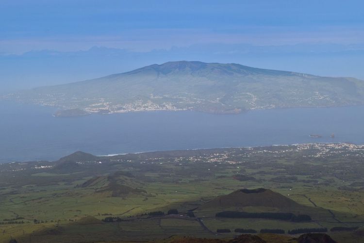
Faial's centrepiece is a 2km-wide crater with a rim path running the full circle, about 8km of walking with the caldera's green bowl on one side and the ocean on the other. On a clear day Pico's cone floats across the channel, which is either inspiring or intimidating depending on what you've booked for tomorrow.
You'll want visibility for this one, so check the webcam before the drive up. Pair it with the Capelinhos volcano on the island's west tip, where the 1957 eruption buried a lighthouse in ash and the landscape still reads lunar. The Faial tours roll both into one day with transport sorted, and the island guide has the full picture.
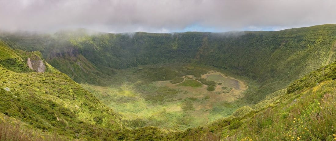
Photo: Diego Delso, CC BY-SA 4.0 (Wikimedia Commons)
São Jorge: the fajã path
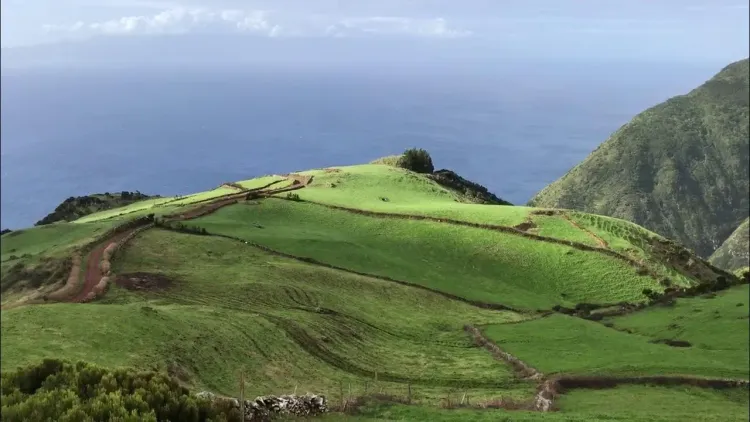
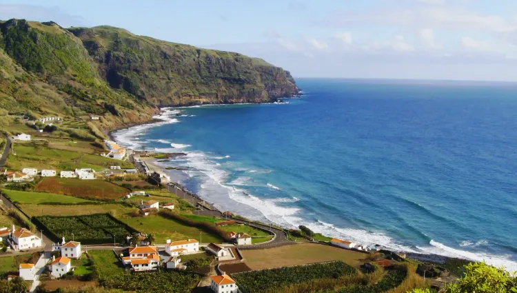
São Jorge is a 50km knife of an island, and its treasures sit on the 'fajãs', the flat shelves of old landslides and lava deltas at the base of the cliffs. The classic PR01SJO route drops from Serra do Topo to the Caldeira do Santo Cristo, a lagoon-side hamlet famous for clams and surf, then continues along the coast to Fajã dos Cubres. Walked as an out-and-back from the coast it's around 10km; with a taxi drop at the top it becomes a mostly-downhill traverse.
This is my favourite walking on the archipelago: hydrangea hedges, ruined stone houses being slowly reclaimed, and a lagoon village that still has no proper road. The café at Santo Cristo serves the clams the fajã is known for, and yes, that counts as trail nutrition. More on the island in the São Jorge guide.
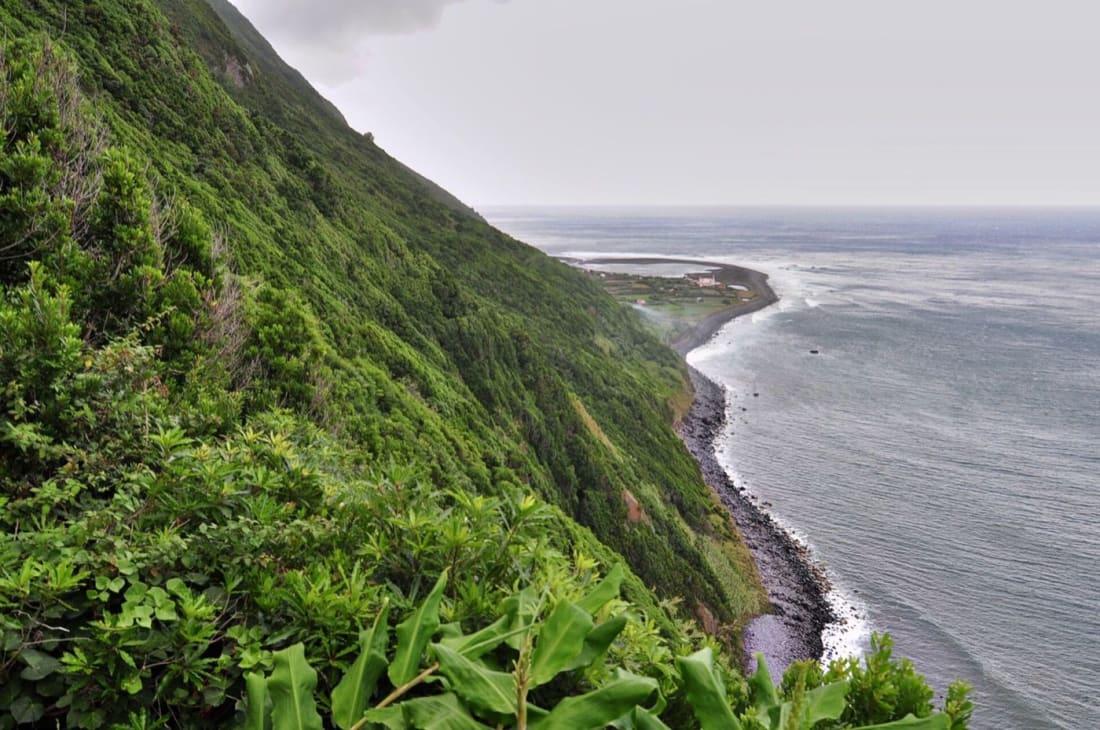
Photo: pedrik, CC BY 2.0 (Wikimedia Commons)
Terceira: Mistérios Negros
Terceira hides its best walk inland: the Mistérios Negros loop, about 5km through a volcanic interior of black lava domes, moss forest and ground that steams gently near the Furnas do Enxofre. The 'mistérios' are the dark, barely-vegetated lava flows from the 1761 eruption, and the trail threads between them on boardwalks and mud.
Expect actual mud, by the way, whatever the season. This is the walk for a morning when the coast is windy, and it pairs naturally with Algar do Carvão, the lava tube you can descend into by staircase. The Terceira guide covers both, plus the island's excellent beef situation, which matters after a hike.
São Miguel: the Sete Cidades rim
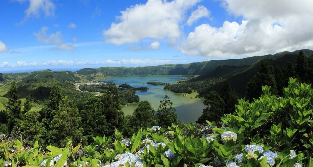
The postcard. From the Mata do Canário aqueduct, the rim trail runs 11.8km along the crater edge to Sete Cidades village, with the twin lakes (one green, one blue) filling the caldera below. It's a one-way route of about 3 hours with modest climbing, and the views start early and simply refuse to stop.
Two notes from repeated experience. First, this is the one Azorean trail with real crowds, so start by 9am. Second, the fog lottery is merciless here: if the webcam shows a white wall at Vista do Rei, swap the day. Ten minutes off the rim, the Boca do Inferno spur hands you the photo every feed knows, with the small Lagoa de Santiago pooled in its own side-crater below. Logistics favour a taxi or tour drop at the trailhead, since the route ends a long way from where it starts. Guided versions run daily from Ponta Delgada, and the São Miguel guide lists the independent options.
São Miguel: Lagoa do Fogo
Fogo is the wilder crater: a protected reserve with a white-sand shore inside a volcano. From the Barrosa viewpoint on the crater's rim, a steep path drops to the lake in about 2km, and the return climb is the workout you'll remember. Count on roughly 4km round trip and an honest 1.5 hours, plus swim-and-stare time at the bottom. Bring swim gear in summer. The water is cold, and you'll be glad anyway.
The reserve rules are strict (no camping, pack everything out), and the trail closes in bad weather. Check status before driving up, and if the rim is in cloud, the Lagoa do Fogo tours usually know the weather windows better than the forecast does.
Pico: the summit of Portugal
Mount Pico is the country's rooftop at 2,351m, a volcanic cone rising straight from the sea, and the only Azorean hike with rules and paperwork. The climb starts at the Casa da Montanha (1,220m): registration, €25, a safety briefing and a GPS tracker that comes back down with you. From there it's around 8km round trip, 6 to 8 hours, on lava that asks for hands in places. The final scramble up Piquinho, the 70m summit cone, runs on a 20-minute limit and steams gently underfoot.
Stand on Piquinho at dawn and you're above every other rock in Portugal, with the shadow of the volcano laid across the sea toward São Jorge.
Do you need a guide to climb Mount Pico? No, a guide isn't mandatory: solo climbers can register, pay the €25 and carry the tracker. A certified guide is still the right call in shoulder season, for night ascents timed to sunrise, or if scrambling on loose volcanic rock is new to you. The mountain closes to independent climbers in rough weather, guides get earlier starts, and the descent punishes tired knees more than the way up. Slots cap at 320 climbers a day, so book the official portal well ahead for July and August. The Pico island guide covers the vineyards waiting at the bottom.
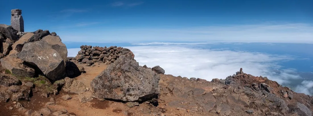
Photo: Jules Verne Times Two, CC BY-SA 4.0 (Wikimedia Commons)
The other three, in one honest paragraph
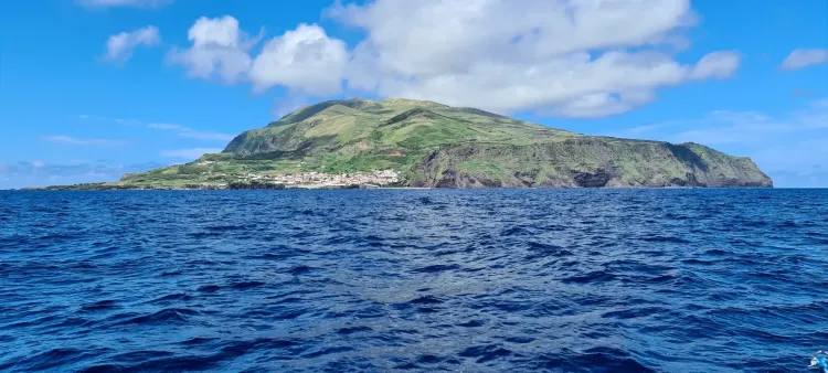
Graciosa's best walk circles the Caldeira and drops into the Furna do Enxofre cave by a 1930s spiral staircase, down to a sulphur lake in volcanic darkness; the Graciosa guide makes the case for the whole island. Corvo, population 400, offers one real trail: down into the Caldeirão crater, with hydrangea islets in the lake, and the summer boat from Flores turns it into an easy day trip.
Santa Maria plays a different game. The Pico Alto forest path is short and green, the coastal routes drop to pale sand you won't find on the other islands, and the southern position catches the archipelago's kindest weather. Save it for the end of a trip, when your knees want mercy and the sea finally feels warm.
Getting between the islands (and to the trailheads)
Island hopping is the hidden line item in an Azores hiking plan. Ferries run within each island group (the Faial, Pico and São Jorge triangle works brilliantly for walkers), while the longer legs go by SATA's prop planes. The full breakdown of routes, seasons and booking quirks lives in the island hopping guide, and it's worth reading before you fix any hike days.
On the islands themselves, hire a car everywhere except Corvo. Trailheads scatter along caldera roads with no bus service, taxis need pre-arranging outside the main towns, and the one-way classics (Sete Cidades, the fajã path) always leave you far from the start. The adventure tours on the Azores solve exactly this, bundling the drop-offs with a guide who watches the weather so you don't have to.
Planning a multi-day hiking trip
The classic mistake is trying to hike all nine islands in two weeks. You'll spend the holiday in airports. A better shape for a first visit runs 9 or 10 days across two groups: give 4 days to São Miguel for Sete Cidades, Fogo and the Furnas valley, then fly to the central group and spend 5 with the Faial, Pico and São Jorge triangle, where the ferries take about 30 minutes between islands and every crossing doubles as an unofficial whale watch. Put the Pico climb in the middle of that stay, so a weather delay has somewhere to go.
With more time, add the western pair: Flores for the waterfall walks, Corvo for the crater, one flight and one boat. Guided multi-day packages trace the same triangle with luggage transfers and a plan B for each island. They cost more than organising it yourself, and they remove exactly the day that usually goes wrong. Either way, book the Pico slot first and build the rest of the trip around it, not the other way round.
What to pack for Azorean trails
Pack for four seasons and assume you'll meet three of them. My standing kit: waterproof jacket regardless of forecast, a warm layer for crater rims, real hiking shoes for mud (Terceira and São Jorge specialise in it), a litre of water per person and sun cream for the moments the cloud parts. Add walking poles for Fogo's descent and Pico's loose rock.
Two Azorean specifics. There are no mountain huts or trailside cafés on most routes, so carry your own food. And download offline maps before you fly: coverage drops out in the calderas, and trail junctions on the fajã paths deserve better than guesswork. Gaiters earn their space in your bag from November to April.
FAQ
Is the Azores good for hiking?
The Azores rank among Europe's best hiking destinations: nine volcanic islands with free, waymarked trails, crater lakes, coastal fajã paths and Portugal's highest summit. The network suits everything from one-hour waterfall walks on Flores to the 6-to-8-hour Pico climb.
How long does it take to hike up Pico?
Most climbers take 6 to 8 hours for the round trip from the Casa da Montanha, including the summit scramble. Sunrise ascents leave around 1am and take similar total time. Add margin: the descent on loose lava is slower than first-timers expect.
How difficult is it to climb Mount Pico?
It's a hard hike rather than a technical climb: around 1,100m of ascent on volcanic rock, with hands-on scrambling near the top and a steep, knee-heavy descent. Fit hikers manage it without ropes. Weather is the real difficulty, and the mountain closes in bad conditions.
Can you climb Mount Pico without a guide?
Yes. Independent climbers register at the Casa da Montanha, pay €25 and carry a mandatory GPS tracker, within the daily cap of 320 people. Guides are required only outside official conditions, and they're strongly recommended for night climbs and shoulder-season attempts.
When should you not visit the Azores?
December to February is the riskiest window for a hiking trip: Atlantic storm fronts bring rain, closed high trails and cancelled inter-island flights. The islands stay green and walkable between systems, but build slack into any winter itinerary rather than a fixed hike-per-day plan.
For the full national picture, from Madeira's ridges to the mainland's coastal trails, see the hiking in Portugal guide.
End the trip the Azorean way. After Pico, drink a glass of verdelho in Madalena from vines grown in lava corrals; after Fogo, book a 'cozido' in Furnas, the stew that spends six hours cooking underground in volcanic steam. And bring a wedge of São Jorge cheese home in your pack. It survives the flight better than your legs will.