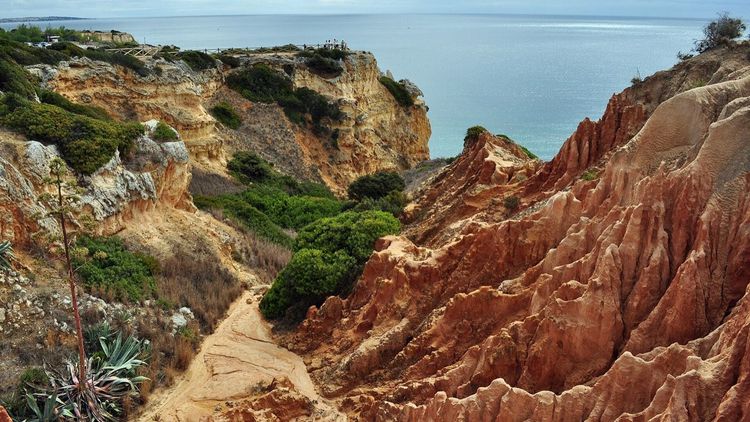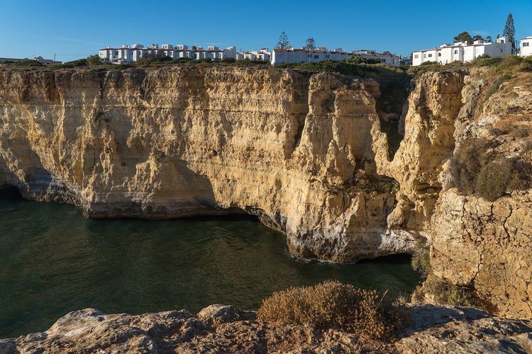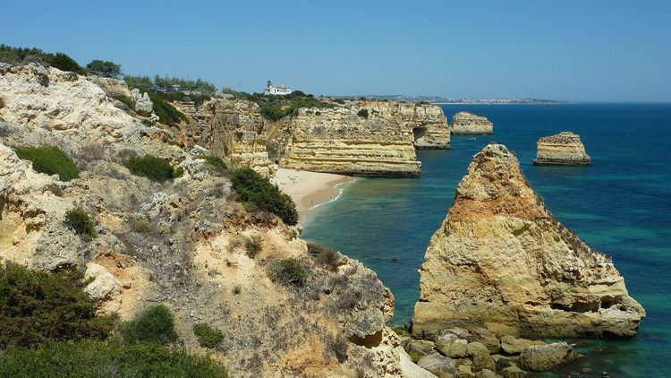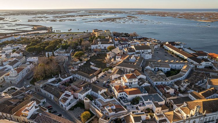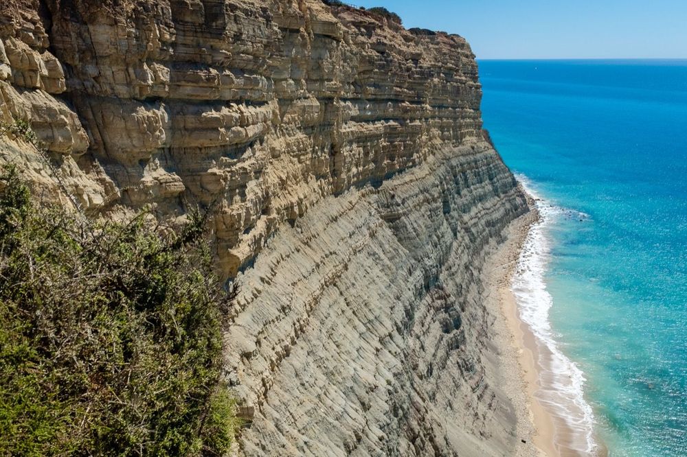
For generations, the fishermen of the Alentejo coast cut their own paths along the clifftops, down to coves where they cast lines for sea bass and pried 'percebes' (goose barnacles) off the rocks at low tide. Those working trails are now the Trilho dos Pescadores, the Fisherman's Trail, the coastal spine of the Rota Vicentina network, and they add up to the best long-distance walk in Portugal. You'll walk on their paths, through their villages, past their boats winched up impossible slipways.
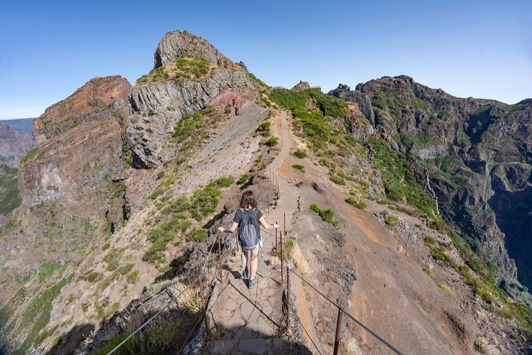
The trail hugs the edge of the Southwest Alentejo and Vicentine Coast Natural Park, one of the last long stretches of wild Atlantic coastline left in southern Europe. No entry fee, no permit, no booking portal: while Madeira's famous ridge walk now runs on tickets and time slots, here you just lace up and start walking. The full route runs 230km (143 miles) from São Torpes to Lagos, and the classic four-day section between Porto Covo and Odeceixe is the part everyone means when they say they've walked it.
Key Takeaways
- The classic Fisherman's Trail is the 76km (47-mile), 4-stage stretch from Porto Covo to Odeceixe, walked north to south. The full route continues to Lagos for 230km and 11 to 13 days. How long does the →
- There's no fee, no permit and no booking system. Your only reservations are beds, and in the May to October season the small villages sell out weeks ahead. Beds, dinners and what →
- Sand is the real difficulty. Distances read easy, but long stretches run over dunes and soft cliff-top paths, and hikers measure this trail in sand hours rather than kilometres. Sand, kit and the →
- September to June is the season. In July and August the heat is serious and shade is nearly nonexistent, so summer walkers start at dawn and finish by early afternoon. When to walk it →
- Getting there is simple: an express bus from Lisbon reaches Porto Covo in about 2.5 hours for roughly €16. Where do you start →
How long does the Fisherman's Trail take?
The classic Fisherman's Trail takes 4 days: 76km (47 miles) from Porto Covo to Odeceixe, split into stages of roughly 20, 15, 22 and 18km. That's the original route and still the best-loved one, with a village, beds and grilled fish waiting at the end of every stage.
The full trail is a different commitment. Since the network was extended, the Fisherman's Trail proper runs about 230km (143 miles) from São Torpes all the way to Lagos in the Algarve, taking 11 to 13 days with around 4,400m of cumulative climbing. Between the two sits a popular 9-to-10-day compromise, Porto Covo to Sagres, that ends at the cliffs where Europe runs out. Most first-timers do the four days, promise themselves the rest, and come back within two years. The pattern is reliable enough that the guesthouse owners joke about it.
Where do you start the Fisherman's Trail?
Start in Porto Covo, a small whitewashed fishing village 170km (105 miles) south of Lisbon, and walk south with the prevailing wind at your back. Technically the route now begins at São Torpes beach 10km further north, and purists add it as a warm-up, but Porto Covo has the transport, the beds and the sense of a proper trailhead.
Getting there is refreshingly cheap. The Rede Expressos bus from Lisbon's Sete Rios station runs direct to Porto Covo in around 2.5 to 3 hours for about €16, several times a day in season. Coming back from Odeceixe, buses connect north to Lisbon or south into the Algarve, so the walk slots neatly into a bigger Portugal trip. If you'd rather not carry everything, local luggage-transfer services move your bag between villages for a few euros per stage, and your shoulders will consider it the best money on the trip.
Picking your itinerary
Four formats cover almost everyone. Here's how they stack up:
| Itinerary | Distance | Days | Who it suits |
|---|---|---|---|
| Classic: Porto Covo to Odeceixe | 76km | 4 | First-timers, long weekends |
| Classic plus: São Torpes start, rest day in Milfontes | 90km | 6 | Photographers, swimmers |
| Porto Covo to Sagres | 191km (119 miles) | 9-10 | Fit walkers wanting the full wild coast |
| Full trail: São Torpes to Lagos | 230km | 11-13 | Completists with a spare fortnight |
Two planning notes make all of them better. First, walk north to south. The prevailing 'nortada' wind blows down this coast most of the year, and having it push your back instead of sandblasting your face is the difference between a walk and a workout. Second, build the trip around beds, not distances. The villages are fixed points and the stage lengths follow from them, so decide where you want to wake up and the itinerary writes itself.
If four days is still too many, the trail forgives day-trippers. Every stage village has parking and bus links, so you can walk any single stage out and back, and stage 3 makes the strongest case for the honour.
Ask anyone who's finished the trail what it was like and watch them skip the distances entirely. They'll tell you about the sand. This is a route you measure in sand hours, not kilometres, and the sooner you accept that, the happier your four days will be.
The four classic stages
The stage villages come in the right rhythm: far enough apart to earn dinner, close enough that nothing needs to be heroic. Waymarking is green and blue stripes on posts and rocks, and it's consistent enough that you'll navigate by eye all week.
Stage 1: Porto Covo to Vila Nova de Milfontes, 20km (12.5 miles)
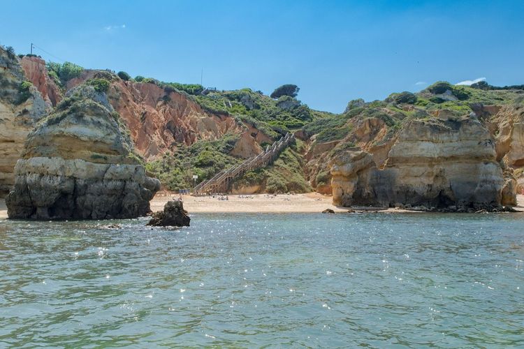
The opening day is a sampler of everything the trail does: clifftop singletrack, coves you'll want to keep secret, and the first long arguments with soft sand. An hour in, you'll pass Praia do Pessegueiro and its offshore island, where a 16th-century fort sits half-ruined against the Atlantic. It was built to guard a harbour that pirates kept visiting anyway. That's the history lesson, and the trail delivers it without slowing down.
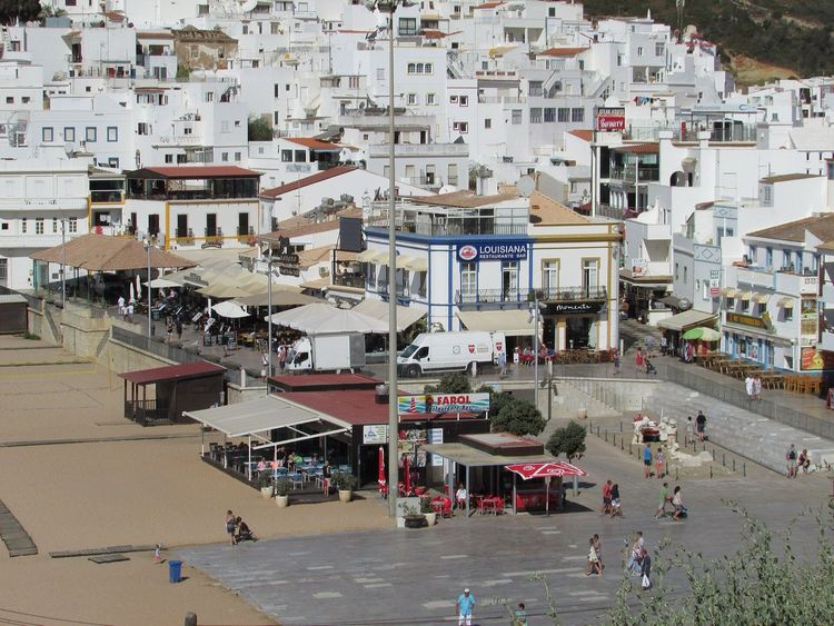
The sand sets the day's character. Long dune sections roll between beaches, and by early afternoon you'll have developed the flat-footed shuffle every trail veteran swears by. The stage ends at Vila Nova de Milfontes, the biggest town on the route, draped over the mouth of the River Mira with beaches on both banks. It has proper restaurants, a pharmacy and an ice-cream habit. Use all three.
Practicalities for the day: carry your full water ration from Porto Covo, because the 20km offer exactly zero taps, and the one mid-stage café that sometimes operates near Praia do Malhão keeps a schedule best described as artistic. The compensation is Malhão itself, a vast run of wild beach where the trail walks the dune crest above surfers and the occasional unofficial naturist. By the time Milfontes' white lighthouse appears across the river mouth, you'll have earned the town's entire dessert menu.
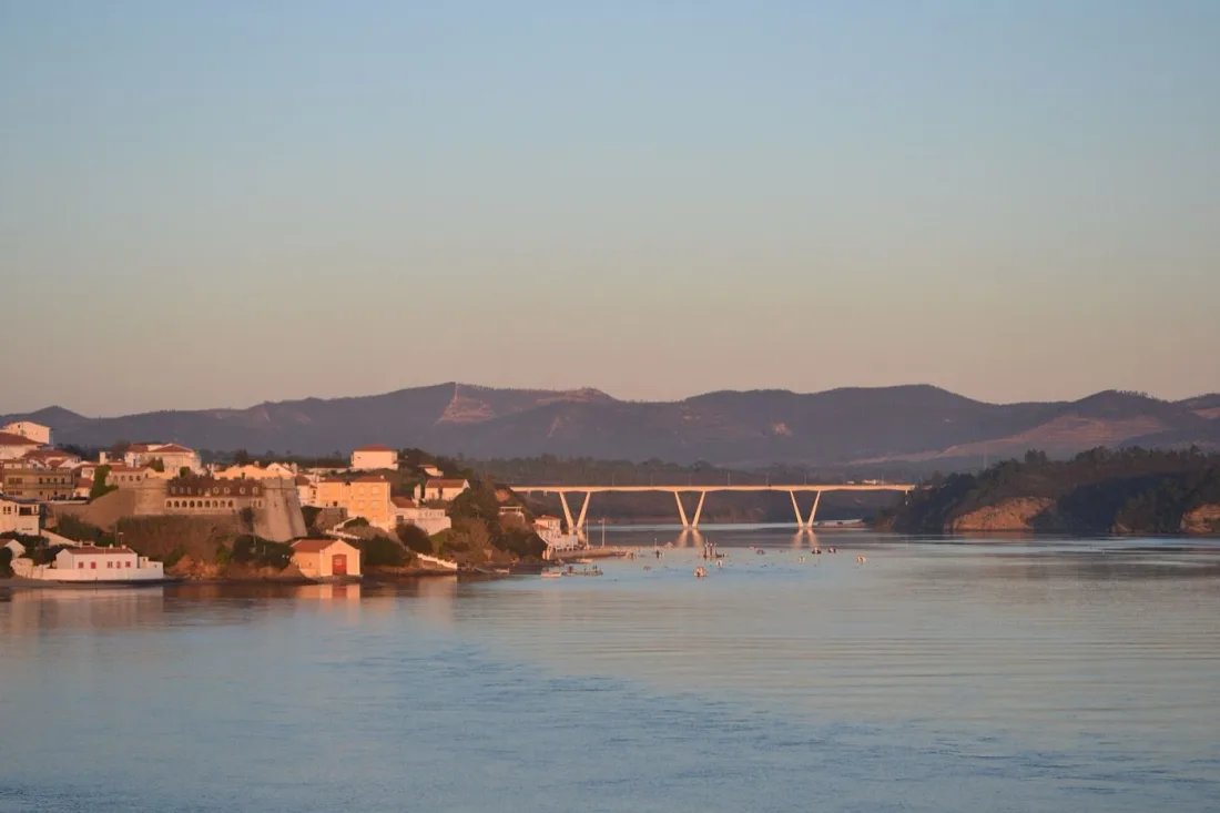
Photo: Maria Barbosa Viana, CC BY-SA 3.0 (Wikimedia Commons)
Stage 2: Vila Nova de Milfontes to Almograve, 15km (9 miles)
The short day, and it opens with a decision. The official route walks inland to cross the Mira by bridge; the traditional move is the small ferry across the river mouth, a five-minute crossing that locals have used forever and that saves the dullest tarmac of the week. Check it's running the evening before, since it keeps fisherman's hours, not ferry timetables.
South of the river the coast turns darker and more dramatic, black schist ledges under red-gold dunes. This is also where you'll likely meet the trail's celebrity residents: white storks, nesting on sea stacks and cliff pinnacles just offshore. The Alentejo coast is one of the very few places in Europe where they breed on ocean cliffs rather than church towers, and the sight of a stork riding the sea wind never quite files itself under normal. Almograve arrives early enough for a beach afternoon.
Use the short day well. Almograve itself is a plain, friendly grid of streets a kilometre back from its beach, with two or three restaurants and a shop for tomorrow's picnic. The move is a late-afternoon walk out to the small harbour at Lapa das Pombas, where the boats sit hauled up the slipway and the evening light does its best work on the black rock. Dinner is grilled fish, again. You will not be tired of it yet.
Stage 3: Almograve to Zambujeira do Mar, 22km (14 miles)
The longest stage and the one people remember. The morning runs out to Cabo Sardão, where a lighthouse from 1915 stands over some of the tallest cliffs on the route, and the stork nests below the light get photographed more than the lighthouse does. Around the cape, the trail threads tiny working harbours, boats hauled up slipways cut impossibly into the rock face, and you'll understand exactly whose trail this was.
It's also the day the sand and the distance gang up. There's little shade, a couple of long dune crossings, and by the 18km mark the day feels honest. Then Zambujeira do Mar appears, a village parked on a clifftop directly above its beach, and the evening view from the bar terraces makes the whole stage retroactively reasonable. Book dinner early in summer; the village is small and everyone walked the same distance you did.
Break the stage at the fishing harbour of Entrada da Barca, just past Cabo Sardão, where a seasonal café sometimes serves cold drinks metres from the boat winches. Otherwise the day is self-supported: two litres of water minimum, a real picnic, and sun cover for the shadeless middle hours. The reward structure is reliable, with the hardest kilometres delivering the biggest cliffs.
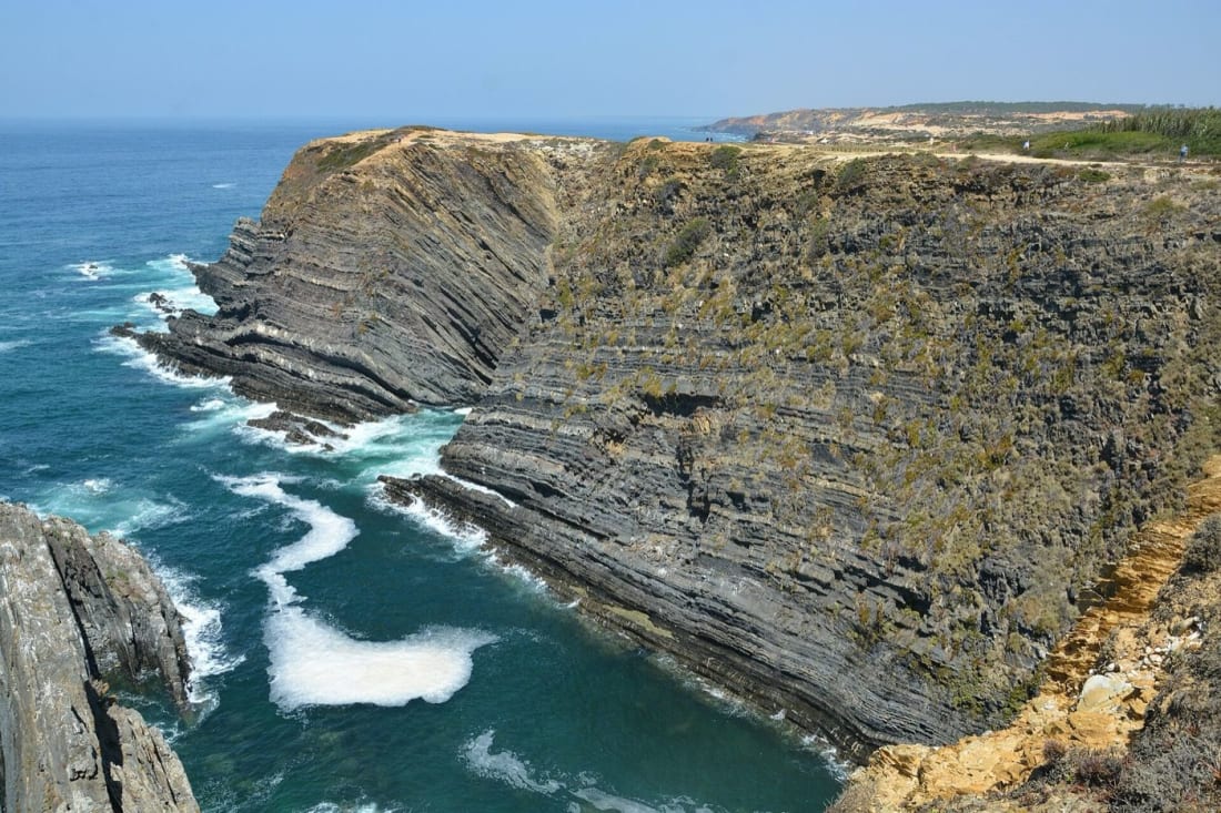
Photo: Silas Szwarcberg Cunha, CC BY-SA 4.0 (Wikimedia Commons)
Stage 4: Zambujeira do Mar to Odeceixe, 18km (11 miles)
The final classic stage saves two of the best moments for last. Mid-morning you'll drop into Azenha do Mar, a hamlet that's essentially one tiny harbour and one famous seafood restaurant, where the catch comes up the slipway and onto the grill with minimal paperwork in between. Arriving on foot at 11am gives you the moral licence to eat like it's dinner.
The trail then follows the River Seixe inland to Odeceixe (pronounced oh-deh-SAYSH), where the river makes a final lazy curve around one of Portugal's most photographed beaches before giving up to the Atlantic. Crossing the river means crossing into the Algarve: the classic walk ends here, on the regional border, with a climb up to a village of white houses and a windmill. The beach below deserves your last afternoon.
| Stage | Route | Distance | Time | The moment |
|---|---|---|---|---|
| 1 | Porto Covo to Vila Nova de Milfontes | 20km | 5-6h | Pessegueiro island fort |
| 2 | Milfontes to Almograve | 15km | 4h | Storks on the sea cliffs |
| 3 | Almograve to Zambujeira do Mar | 22km | 6-7h | Cabo Sardão lighthouse |
| 4 | Zambujeira to Odeceixe | 18km | 5h | Azenha do Mar seafood, Seixe river curve |
Which part is the most beautiful?
Stage 3, Almograve to Zambujeira do Mar, is the consensus pick for the most beautiful part of the Fisherman's Trail. Cabo Sardão's cliffs, the stork colonies and the working harbours pack the route's whole identity into one long day, and the consensus is right. If you only have one day rather than four, base yourself in Zambujeira or Almograve and walk that stage as an out-and-back taster.
There's a strong minority vote for the last hour into Odeceixe, where the river bends around the beach, and it's the single most photogenic spot on the route. For a one-day coastal walk further south with a similar wow-per-kilometre ratio, the Seven Hanging Valleys Trail near Carvoeiro is this trail's Algarve cousin: shorter, busier and dressed in golden limestone instead of dark schist.
When to walk it
September to June is the season, with two sweet spots. September and October bring warm sea, soft light and emptied-out villages once the Portuguese holidays end. March to May turns the clifftops into a botany lesson, with rockroses and hottentot figs flowering along every kilometre, and the storks busy on their nests. Winter walking works too on this coast, mild at 15 to 18°C most days, with the caveat that Atlantic fronts occasionally park themselves overhead for 48 hours.
July and August need honesty rather than a ban. The heat regularly passes 30°C, shade is a rumour, and the sand doubles the effort tax. If summer is what you have (you're reading this in July, so it may be), walk like the locals work: start at first light, be done by 1pm, spend the afternoon in the ocean, and book beds well ahead, because these villages are also beach resorts in their own right. Our Algarve seasons guide covers the same logic for the coast the trail finishes on.
For calendar planners, the fine print runs like this. September brings 24 to 27°C days, a 20°C sea and free beds midweek. October cools the air, keeps the ocean warm and adds the first dramatic skies. November through February are the quiet months: expect 15 to 18°C, roughly one wet day in three, and villages running at winter speed with some restaurants shuttered. March wakes the flowers, April and May perfect the walking temperatures, and June sneaks in as summer's polite younger sibling before the July heat arrives with opinions.
Beds, dinners and what it costs
The Fisherman's Trail runs village to village, so a tent is optional equipment and wild camping is banned inside the natural park anyway. Each stage town has guesthouses, small hotels and a hostel or two; expect roughly €60 to €90 for a double in season, less in spring and autumn, and book ahead from May through October. The trail's popularity has outgrown the villages' bed count, which is the one piece of planning this walk genuinely demands.
Daily costs stay friendly. A café breakfast of a filled roll, a pastel de nata and coffee runs about €4, a picnic lunch from a minimercado costs little more, and dinner is the day's event: grilled fish, a salad, a bottle of Alentejo white, maybe €15 to €25 a head if you resist the seafood platter and roughly double if you don't. Carry cash for the smallest cafés, and try the percebes once, if only to watch the technique demonstration your waiter will provide unprompted.
A realistic daily budget lands around €80 to €110 per person travelling as a pair: bed, breakfast, picnic, dinner with wine, and the occasional ice cream toll. Solo walkers pay more per night, spring and autumn shave €15 to €20 off the total, and the €16 bus from Lisbon keeps the access cost almost decorative. Compared with the Camino's crowds or an Alpine hut trek's prices, the value here is quietly absurd.
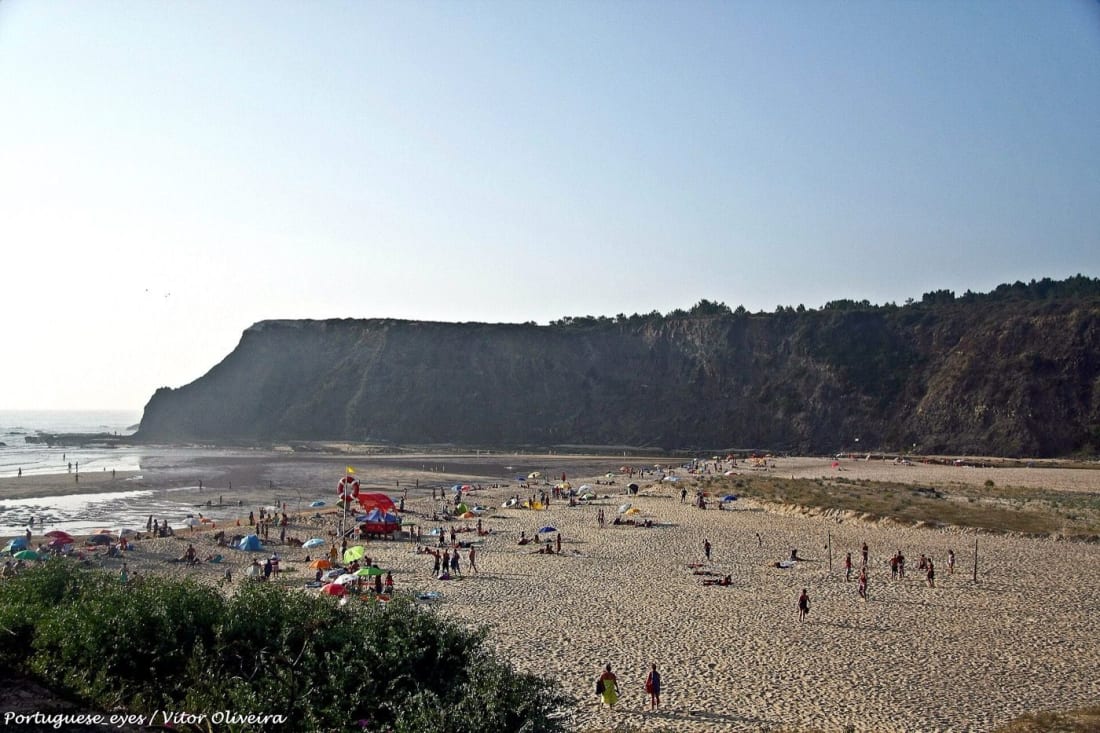
Photo: Vitor Oliveira, CC BY-SA 2.0 (Wikimedia Commons)
Sand, kit and the honest difficulty
The Fisherman's Trail is moderate on paper and sneaky in practice. There's little serious climbing, nothing exposed and no navigation puzzle, so the numbers suggest an easy week. What the numbers miss is the surface: hour after hour of soft sand and loose dune path, which taxes calves and morale at roughly 1.5 times the posted distance. Fit walkers finish every stage comfortably. Overconfident ones rename stage 3.
Kit follows from the sand. Trail runners or light hikers beat heavy boots here, gaiters or high socks keep the sand out, and poles earn their weight on the dunes. Carry 2 litres of water per person per stage, because refill points between villages are rare and the wind dehydrates you as efficiently as the sun. Add real sun protection, a windproof layer for the cape sections, and swimwear, since the trail passes a dozen beaches a day and refusing all of them is a personality flaw.
Navigation barely counts as a task, and you should still prepare it. The official Rota Vicentina site publishes free GPX files for every stage, the green-blue waymarks appear every couple of hundred metres, and phone signal holds along most of the coast. Download the offline maps anyway. The one navigational sin here is following an older track along a collapsed cliff edge, so when a diversion sign argues with your app, the sign wins. Cliff erosion redraws small sections most winters.
Beyond Odeceixe
South of the Seixe river the trail carries on down the Costa Vicentina with the same waymarks and a wilder mood. The stage towns spread further apart and the services thin out, which filters the crowd to the committed. Highlights come steadily: the whitewashed hill town of Aljezur with its Moorish castle ruin, Arrifana's crescent bay, the surf classroom at Praia do Amado, and the dune circuit at Carrapateira where the boardwalks hang over a coast that looks borrowed from somewhere far less visited.
The grand finale takes two days. From Vila do Bispo the path crosses an empty plateau to the lighthouse cliffs of Cabo de São Vicente, the continent's southwestern full stop, where the trail's name finally explains itself. Beyond Sagres the coast turns east and softens: the last stages to Lagos trade wild cliffs for fishing villages like Salema, a warmer sea, and an ending among the golden sandstone stacks of Ponta da Piedade. This lower coast doubles as one of Europe's great surf zones, and our surfing in Portugal guide covers the same beaches from the water's side.
The network itself is young. In the early 2010s a local association of guesthouse owners, farmers and municipalities linked the old fishing paths and rural tracks into a signed system, betting that walkers would bring the coast a gentler income than another marina. The bet paid off: the Rota Vicentina now counts around 750km of marked routes and has become the reference for what low-key tourism can do for a rural coastline.
The inland half of the Rota Vicentina network, the Historical Way, offers a parallel route through cork oak country and hill villages if the coast ever blows out. Mix-and-match is legal and encouraged: plenty of walkers take the Historical Way inland for a windy day and rejoin the coast the next morning.
The mistakes everyone makes once
Four errors account for most of the trail's bad days, and all four are cheap to avoid. Walkers underestimate the sand and plan Camino-style 30km days, which this surface punishes without appeal. They carry too little water, budgeting like it's a forest walk with springs, when the honest ration is 2 litres and none of it optional. They book beds late and end up taxiing to an off-route town and back, paying more for the ride than the room. And they skip the swim, treating the beaches as scenery. The bus home is where they realise the Atlantic was the point.
There's a fifth, quieter mistake: rushing stage 2. The 15km (9-mile) day looks like a half-day to bank extra kilometres, and it's actually the trail handing you an afternoon off in a beach village. Take the gift. The trail knows what it's doing.
The last table
End the classic route the way the trail ends everything: at a table. Up in Odeceixe village, the tascas grill the morning's fish and pour Alentejo wine at prices that haven't heard of the trail's fame, and the terrace views run down the river valley you just walked. Order the catch of the day, count your remaining blister plasters, and start negotiating with yourself about the nine stages you haven't walked yet. The trail usually wins that negotiation.
FAQ
Is the Fisherman's Trail part of the Camino de Santiago?
No. The Fisherman's Trail belongs to the Rota Vicentina, a separate Portuguese trail network with no connection to the Camino routes. The confusion comes from the similar waymark style and the multi-day village-to-village format, but there's no pilgrimage tradition here, only fish.
What does Rota Vicentina mean?
Rota Vicentina means the Vicentine Route, named after Cabo de São Vicente (Cape St. Vincent), the dramatic headland at the network's southern end. The network bundles the coastal Fisherman's Trail, the inland Historical Way and a set of circular day routes, about 750km of marked paths in total.
Where do you sleep on the Fisherman's Trail?
You sleep in beds, in the stage villages. Porto Covo, Vila Nova de Milfontes, Almograve, Zambujeira do Mar and Odeceixe all have guesthouses, small hotels and hostels. Wild camping is prohibited inside the natural park, and in the May to October season the villages genuinely sell out, so book beds before you book anything else.
Do you need a permit or ticket for the Fisherman's Trail?
No. As of July 2026 the trail is free to walk, with no permits, entry fees or booking slots, a refreshing contrast to Madeira's ticketed PR1. The only things you reserve are accommodation and, if you use one, the luggage transfer.
Can you swim along the trail?
Yes, and you should: the route passes beaches constantly, from Pessegueiro to Odeceixe. Pick the ones with summer lifeguard flags for proper swims, treat the empty coves with Atlantic respect, and remember the water runs 17 to 20°C even in August. It wakes you up better than the coffee.