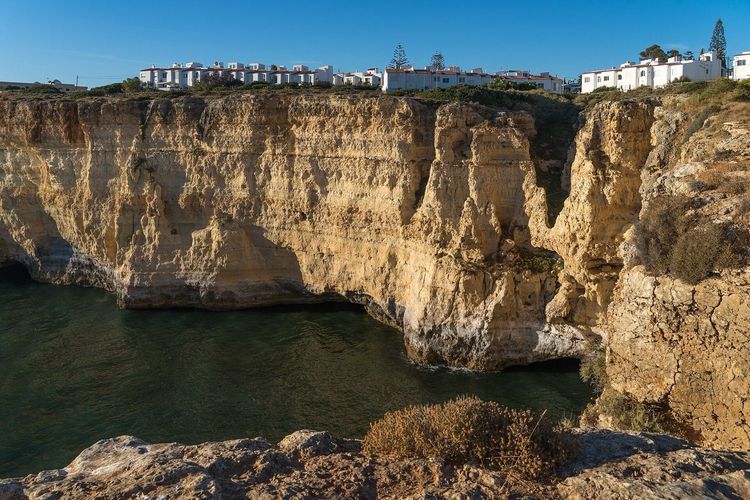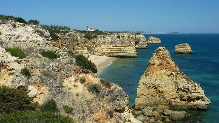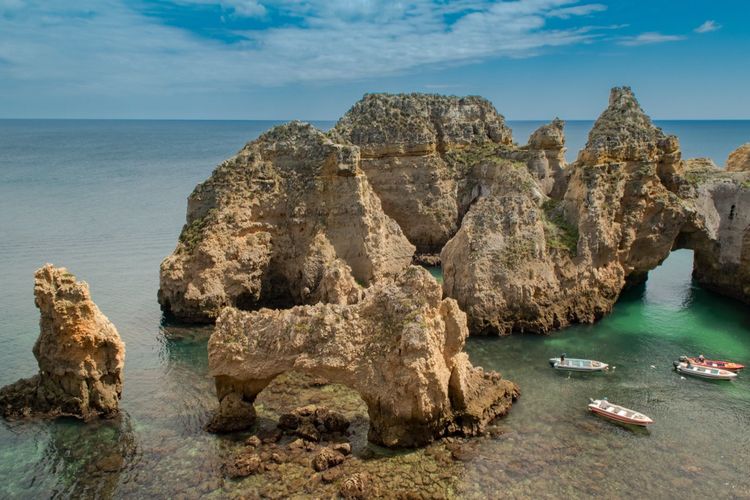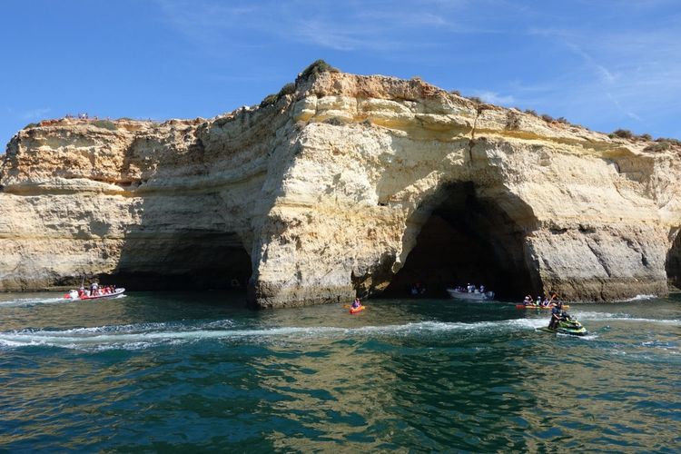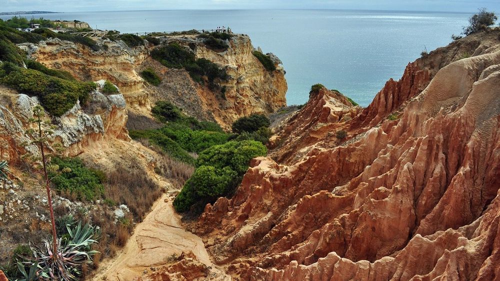
I hike for a living on an island where the trails go up. Madeira taught me that a proper coastal path should punish you a little, so I flew to the Algarve half expecting a boardwalk with pretensions. The Seven Hanging Valleys Trail corrected me within the first kilometre. This is 5.7km of golden clifftop between Praia da Marinha and Praia de Vale Centeanes, stitched together over sea caves, sinkholes and coves you'll want to climb down into, and it has topped European best-hike lists for good reason.
It's also refreshingly uncomplicated. No permits, no fees, no time slots: you park, you walk, and the Atlantic does the rest. After my home island wrapped its famous paths in a booking system this year, that simplicity felt almost radical. Here's everything you need to plan it properly, from a hiker who measures every trail against volcanic staircases.
Key Takeaways
- The official route runs 5.7km one way between Praia da Marinha and Praia de Vale Centeanes (11.4km out and back), near the town of Carvoeiro. How long is the →
- Count on 2 to 3 hours one way, or a 4-to-6-hour day with beach stops. It walks well in either direction; east to west keeps the sun behind you. The route, east to →
- The trail is free, unfenced in the wrong places and completely unbookable, in the best sense. The only queue is for parking at Marinha after 9am in summer. Trailheads, parking and getting →
- You'll pass the roof of Benagil Cave: a fenced 'algar' (collapsed sinkhole) looking straight down into it. Entering the cave itself happens by licensed boat or kayak only. Making a full day →
- Difficulty is easy to moderate: a sawtooth of short climbs on rocky, uneven ground. Real shoes, 1.5 litres of water and sun cover are the whole kit list. The trail at a →
- Spring and autumn are the sweet spots. In July and August, start by 8am and treat the beaches as your air conditioning. When to walk it →
The trail at a glance
| Distance | 5.7km one way, ~11.4km out and back |
| Time | 2 to 3h one way, 4 to 6h return with stops |
| Difficulty | Easy to moderate (rocky, repeated short climbs) |
| Start / end | Praia da Marinha ↔ Praia de Vale Centeanes |
| Waymarks | Yellow-and-red PR stripes on posts and rocks |
| Accumulated climb | Roughly 200 to 350m, depending on beach detours |
| Fee / booking | None, year-round |
The route sits in the Lagoa municipality, with Carvoeiro as its base town: 8km by road from the Marinha trailhead, and only about 700m from the Vale Centeanes end. Full trail details live on the official Lagoa trail page.
How long is the Seven Hanging Valleys Trail?
The trail is 5.7km one way, and most walkers need 2 to 3 hours in each direction at photo pace. Out and back it becomes an 11.4km day of 4 to 6 hours, because nobody passes six beaches without stopping at a few.
Those numbers hide the real shape of the walk. The path never climbs higher than about 45m (150ft) above the sea, yet it constantly drops into small valleys and hauls itself out again, so the accumulated climb lands somewhere between 200m and 350m depending on whose GPS you trust and how many coves tempt you down. By Madeira standards that's a warm-up. By flat-holiday standards it's a genuine leg day, and the loose stone underfoot asks for more attention than the postcard views suggest.
If you'd rather not walk it twice, the fix costs less than a beach umbrella: an Uber or Bolt from Vale Centeanes back to the Marinha car park runs about €6 and takes minutes to arrive in season.
Why is it called the Seven Hanging Valleys?
Seven streams once ran off this coast into the sea, and each carved its own small valley through the limestone. The coastline then eroded backwards faster than the streams could cut down, leaving their valley mouths stranded high in the cliff face. Geologists call these 'hanging valleys', and the trail dips through every one of them.
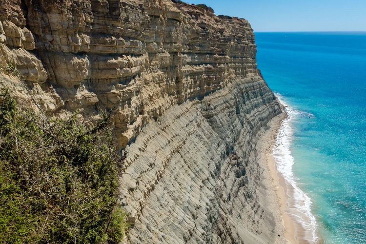
That's the science; the effect is stranger. You walk a coast that has clearly been gnawed, where the land ends in bitten-off arches and freestanding stacks, and where the ground occasionally opens into an 'algar', a sinkhole punched clean through the cliff roof by collapsing caves. The rock is Miocene limestone, young and soft as these things go, and it erodes in decades rather than epochs. Locals will point at arches that have changed shape within living memory. Coming from an island built of basalt that shrugs off the ocean, that speed of change felt quietly unsettling, like watching a coastline age in time-lapse.
The route, east to west
Walking from Marinha toward Vale Centeanes keeps the light at your back for most of the day and starts you at the bigger car park. The path splits naturally into three acts, and the crowds thin as you go.
Praia da Marinha to Benagil (about 2km)
The opening stretch is the postcard factory. Within ten minutes you're above the double arch that made Praia da Marinha famous, the one every Algarve brochure crops into an M shape, and the viewpoints keep coming: Mirador dos Arcos, the hidden sands of Praia da Mesquita, then Praia da Corredoura, a beach with no land access at all. This is also the busiest section, shared with everyone strolling between the two star beaches. Go early and you'll trade the crowds for fishermen and low gold light. The beach itself deserves its own visit, and our guide to the Algarve's best beaches gives Marinha the full treatment.
Benagil and its cave (the 'algar' moment)
Just before Benagil village, the trail passes a round fenced hole in the clifftop. Walk to the rail and look down: you're standing on the roof of Benagil Cave, staring through its skylight at the sand and green water 20-odd metres below.
The strangest view in the Algarve isn't out to sea. It's straight down, through a hole in the ground, into a cathedral the ocean built and lit itself.
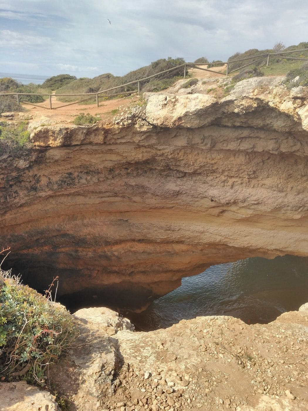
Photo: Threeohsix, CC BY-SA 4.0 (Wikimedia Commons)
Can you see Benagil Cave from the trail? Yes, from directly above, through the fenced skylight, and it's a view the boat passengers never get. What you can't do is climb in: the cave floor is reachable only from the water, on a licensed boat or kayak, and landing on its beach has been banned for several years. The Benagil boat and kayak tours run from the village beach below the trail and from nearby marinas, and the paddle version is the better pick; our full Benagil Cave guide explains the rules, the timing and the swell problem. Benagil beach also has the last proper restaurants until the end of the trail, so eat or top up water here.
Benagil to Praia do Carvalho (about 1.5km)
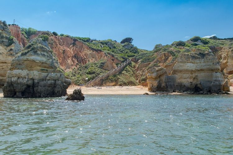
Past Benagil the day-trippers evaporate and the trail becomes a hiker's path again. The reward for the next climb is Praia do Carvalho, my favourite single spot on the route: a pocket of sand walled in by cliffs, entered through a staircase tunnel hand-cut in the rock. It feels like using a secret door. In summer a small kiosk sometimes operates; out of season you'll likely have the tunnel's echo to yourself.
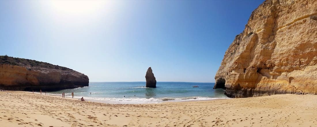
Photo: Reino Baptista, CC BY-SA 4.0 (Wikimedia Commons)
Carvalho to Vale Centeanes (about 2.5km)
The final act is the quietest and, to my legs, the most honest. The path ducks through patches of umbrella pine that finally offer shade, passes a picnic spot, and rounds the red-trimmed Alfanzina lighthouse (lit since 1920). Offshore stands the gaunt sea stack of Leixão do Ladrão (the 'Thief's Islet'), where gulls and the odd peregrine run their own housing market. More 'algares' open beside the path, fenced and booming with wave-echo. Then a last wooden belvedere, a last staircase, and Praia de Vale Centeanes appears below with its seasonal restaurant, close enough to Carvoeiro that a cold drink is never in doubt.
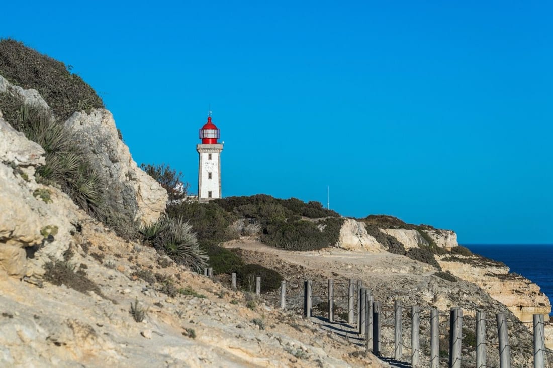
Photo: Alexkom000, CC BY 4.0 (Wikimedia Commons)
Trailheads, parking and getting back
Praia da Marinha (eastern trailhead). The biggest car park on the route, and the reason most people start here. In July and August it fills by around 9am; at sunrise it's yours. The trail leaves from the clifftop by the car park, to your right as you face the sea.
Praia de Vale Centeanes (western trailhead). Smaller parking, quicker access from Carvoeiro, and the smarter start if you're walking in the afternoon, since the sun then sits behind you heading east.
Without a car. Vamus Algarve buses (vamusalgarve.pt) reach Lagoa and Carvoeiro from the coastal towns; from either, a taxi or Uber covers the last few kilometres to the trailhead. From Carvoeiro you can even walk onto the route's western end. Rough driving distances: Carvoeiro 8km, Portimão 18km, Albufeira 28km, Faro and its airport about 59km.
Getting back. Out-and-back is the simple answer and shows you every view twice. One-way walkers grab an Uber (about €6, usually 5 to 15 minutes' wait) or pre-arrange a taxi from Vale Centeanes. With two cars in the group, stage one at each end and the logistics disappear.
If you'd rather hand the whole day to someone local, several Portimão day tours pair the clifftop walk with a boat or kayak leg, which solves both the transport and the cave in one booking.
When to walk it
Spring and autumn are the trail at its best: mild air, flowering scrub full of warblers, and car parks that behave. March to May adds the scent of rockrose; late September to November brings warm sea and empty viewpoints. For the wider seasonal picture, our month-by-month best time to visit the Algarve guide breaks down the whole year.
Summer works with tactics. Start by 8am, carry double water, swim at Benagil or Carvalho in the middle of the day, and save sunset for the last hour, when the limestone glows like a lit lamp and most of the crowd has gone to dinner. Winter is the sleeper season: crisp light, solitude, and only the occasional Atlantic front to dodge. The ground drains fast here. Unlike my home trails, you won't wade a cloud for three days waiting for a window, though high wind is still a reason to skip it, since much of the path runs close to unfenced edges.
What to bring (and what to respect)
Pack like it's a real hike, because it is one. Proper trainers or trail shoes with grip, at least 1.5 litres of water per person, sunscreen, a hat and sunglasses: the route is almost shadeless until the pine stretch near the end. Add swimwear and a small towel, because passing Carvalho without swimming is a failure of judgement. A headtorch is unnecessary; the Carvalho tunnel is short. Phone coverage is good the whole way, and the emergency number is 112.
Two warnings deserve respect. First, the cliff edges are undercut and genuinely brittle; people have died here posing past the fences, and the barriers around the 'algares' exist because the ground beside them is a roof, not rock. Stand on the land side of every rail. Second, there are no bins on the trail at all, so whatever you carry in walks out with you. The scrub between the valleys shelters foxes, chameleons and nesting seabirds that don't need your picnic.
Making a full day of it
The trail's ends invite extensions. From Vale Centeanes, it's worth continuing about 2km into Carvoeiro along the boardwalk to Algar Seco, a wave-carved terrace of rock windows and blowholes that works as a natural dessert course. Around Benagil, the kayak trips from Portimão and boat-and-cave tours from Albufeira let you re-run the morning's clifftops from sea level, which is the only way to understand how hollow this coast really is. And if the Algarve is your whole holiday rather than one hike, the full things to do in the Algarve guide sets the trail in context.
FAQ
Is the Seven Hanging Valleys Trail worth it?
Yes, without hesitation: it's the best day hike in southern Portugal and among the finest coastal walks in Europe. In 5.7km you get sea arches, a lighthouse, hidden beaches and the roof of Benagil Cave. Even measured against Madeira's peaks, it earns its reputation.
How hard is the Seven Hanging Valleys Trail?
Easy to moderate. The path is rocky and uneven with repeated short climbs totalling 200 to 350m, but there's no exposure or scrambling. Fit children handle it well under supervision; the main risks are heat and unfenced cliff edges, not the terrain itself.
Where does the Seven Hanging Valleys Trail start?
Officially at Praia da Marinha in the east, where the parking is biggest, ending at Praia de Vale Centeanes near Carvoeiro. It's waymarked in both directions, so you can start at either end, or join midway at Benagil.
Do you need to book or pay for the trail?
No. The Seven Hanging Valleys Trail is free, open year-round and has no booking system, permits or entry gates. You only pay if you park in a paid lot in high season or add a boat or kayak trip into Benagil Cave.
Can you swim along the way?
Yes, and you should. Praia da Marinha, Benagil and Praia do Carvalho all sit directly on the route with safe summer swimming, and Carvalho's tunnel entrance makes it the most memorable dip. Pack swimwear even in October; the Atlantic here runs warmer than you'd think.
Finish the day the Algarve way. Walk the last kilometre into Carvoeiro, order grilled sardines or a 'cataplana' (the copper-pot seafood stew this coast does best) at a table above the beach, and add a cold Sagres beer. If the waiter offers 'medronho', the local strawberry-tree firewater, say yes once. Your knees carried you over seven valleys. The least you can do is toast them.