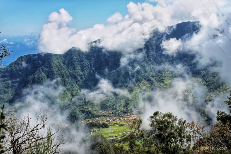
I grew up in Santana, on the wet side of Madeira, where the footpaths start before the garden fences end. Take it from a local, then: hiking in Madeira gives you more mountain per square kilometre than almost anywhere in Europe. The island is 57km long and 22km wide. Inside that rectangle you'll find 1,800m peaks above the clouds and a UNESCO-listed laurel forest older than most countries. Add coastal paths on lava cliffs, plus around 3,000km of walkable 'levadas', the irrigation channels that double as trails.
The walking here is organised around classified 'PR' routes ('percurso recomendado', a recommended trail), which are waymarked, numbered and maintained. That system got a serious update for 2026: the popular trails now require an online booking and a small fee. It changes how you'll plan a hiking trip to the island, so we'll start there before getting into the trails themselves.
This guide covers the 9 hikes that earn a place on a first or second visit, ordered from easiest to hardest. It also carries the practical layer most guides skip: what each trail costs, how long it really takes, where the buses run and which two famous routes you shouldn't plan around this year. Hiking is one big column of the island's appeal, and if you want the rest, our pillar guide to things to do in Madeira has the full picture.
Key Takeaways
- Madeira's classified PR trails now require advance online booking with a fee: €4.50 per person per trail, and €10.50 for the star PR1 traverse. Children up to 12 walk free. Do you need to →
- The booking runs through the official SIMplifica portal in 30-minute entry slots. Book before you drive to the trailhead. Do you need to →
- Best months for hiking in Madeira: April to June and September to October. Summer works too, but start at dawn. What is the best →
- The easiest big-reward walk is Vereda dos Balcões (3km); the hardest on this list are the PR1 ridge traverse and Pico Grande. The 9 best hikes →
- Two classic routes were closed at the time of writing (PR10 Ribeiro Frio to Portela and PR7 Levada do Moinho). Check trail status the night before any hike. The 9 best hikes →
- You'll want a head torch, a warm layer and real hiking shoes. It runs about 10C colder at 1,800m than in Funchal. What to wear and →
Do you need to book Madeira's hiking trails?
Yes. Since January 2026, walking a classified PR trail in Madeira requires an online reservation and a fee of €4.50 per person, paid in advance. The flagship PR1 route from Pico do Arieiro to Pico Ruivo costs €10.50, a higher rate introduced in April 2026. Children up to 12 years old hike free, and Madeira residents are exempt from the fee but still need to reserve a slot.
Everything runs through SIMplifica, the official government portal. You create an account, pick the trail, choose a date and a 30-minute entry window, pay online and keep the QR confirmation on your phone. Wardens do check codes at the busy trailheads, and the PR1 access is gated, so this is a real system rather than a suggestion. Same-day bookings work when slots remain, but the sunrise windows on PR1 disappear days ahead in summer.
A few planning notes from someone who books these regularly. Day and multi-day passes exist (1, 3 and 7 days) and start to pay off around five paid hikes, which suits a serious walking week. The 30-minute window is your entry time, and once you're on the trail nobody hurries you. And the fee applies to the classified network: informal paths like the Larano coastal walk further down this list stay outside the paid system.
If you'd rather not juggle permits, slots and one-way logistics at all, the guided hiking tours in Madeira handle bookings, transfers and a local guide in one go. For point-to-point routes like the PR1, that solves the biggest headache, which is getting back to your car.
What is the best month to hike in Madeira?
April to June and September to October are the best months for hiking in Madeira: stable weather, long days, green mountains and thinner crowds than peak summer. The island stays walkable all year, though, and that's exactly why hikers keep coming back.
The caveats are seasonal. July and August bring heat on the exposed coastal trails, full car parks and a genuine race for sunrise slots on the PR1. Winter, from December to February, delivers the biggest storms: trails close after landslides, and snow lands on the peaks above 1,500m more often than the beach photos suggest. Spring shoulder months carry the best flower cover on the north side, and autumn keeps the sea warm enough that you can pair a summit morning with an afternoon swim.
| Season | On the trails | Verdict |
|---|---|---|
| March to June | Green mountains, stable spells, flowers on the north side | Best all-round window |
| July to August | Hot exposed coasts, clear peaks, full car parks | Fine with dawn starts |
| September to October | Warm sea, settled weather, thinner crowds | Best second pick |
| November to February | Storm cycles, closures, snow above 1,500m | Doable with flexible plans |
One more thing the brochure won't tell you: Madeira is a stack of microclimates. The north coast (my side) catches the moisture, the south coast around Funchal stays dry, and the high ridges make their own weather by lunchtime. Whatever the month, start early. The cloud usually climbs out of the valleys between 10am and noon, and a viewpoint in fog is a car park with extra steps. The exception is Fanal, where the fog IS the show, and you'll understand when you get there.
Are hikes in Madeira difficult?
Madeira's hikes range from flat one-hour strolls to hard mountain days, and the scale runs on exposure more than distance. They're graded, waymarked and shorter than they feel, but plenty of them walk ledges with serious drops an arm's length away.
That exposure is the honest filter. Plenty of fit walkers turn around on the PR1 staircases, and plenty of casual walkers stroll Balcões or the first half of São Lourenço without noticing they're hiking. If heights bother you, test yourself on those two before booking anything with 'ridge' or 'ledge' in the description, and skip the airier sections of 25 Fontes and Larano until you know your head.
Fitness-wise, the island deals in staircases rather than gradients. If you can climb stairs for an hour with a daypack on, the moderate list is yours. Kids do fine on Balcões and the early São Lourenço saddles, and teenagers handle Pico Ruivo from Achada do Teixeira. The full ridge traverse is an adults-and-strong-teens outing, and it earns that label every single week of the year.
The 9 best hikes in Madeira, easiest to hardest
Every trail below is one I've walked repeatedly, most recently to check how the 2026 booking rules land on the ground. The list runs from family strolls to full ridge days. It deliberately skips two famous names: PR10 Ribeiro Frio to Portela, closed by landslide damage, and PR7 Levada do Moinho, shut since 2024. Older guides still recommend both, which tells you how fast advice ages here.
| Trail | Distance | Time | Difficulty | Fee | Start point |
|---|---|---|---|---|---|
| PR11 Vereda dos Balcões | 3km return | 1h | Easy | €4.50 | Ribeiro Frio |
| Fanal forest (+ PR13) | 0 to 10.8km | 0.5 to 4h | Easy to moderate | €4.50 on PR13 | Fanal / Paul da Serra |
| PR8 Ponta de São Lourenço | 8km return | 2.5 to 3h | Moderate | €4.50 | Baía d'Abra |
| PR6 Levada das 25 Fontes | 9km return | 3h | Moderate | €4.50 | Rabaçal |
| Larano to Boca do Risco | 10km return | 3h | Moderate | Free | Porto da Cruz |
| PR9 Caldeirão Verde | 13km return | 4.5 to 5h | Moderate | €4.50 | Queimadas, Santana |
| PR1.2 Pico Ruivo | 5.6km return | 2h | Moderate | €4.50 | Achada do Teixeira |
| PR1 Arieiro to Ruivo | 7km one way (~11km with exit) | 4 to 5h | Hard | €10.50 | Pico do Arieiro |
| Pico Grande | 10km return | 4 to 5h | Hard | Free | Boca da Corrida |
1. PR11 Vereda dos Balcões: the one-hour classic
3km return · about 1 hour · easy · trailhead at Ribeiro Frio
If you have one spare hour on the island, spend it here. From the trout farm hamlet of Ribeiro Frio, a flat path follows the old Levada da Serra do Faial through laurel forest to the 'balcões', the stone balconies over the Metade valley. On a clear morning the viewpoint lines up Pico Ruivo (1,862m), Pico das Torres (1,851m) and Pico do Arieiro (1,818m) across the void. Buzzards ride the updrafts below your feet.
You'll share the path with everyone from toddlers to tour groups, and that's fine, because this is the island's gateway walk. Go before 9.30am for a quiet balcony, and watch for the chaffinches that land on outstretched hands. There's a small bar at the viewpoint and two cafes back at the trailhead.
The honest note: clouds sit on the central peaks by late morning more days than not. If the summit webcams show soup, save your slot for another day. The trail itself is pretty in fog, but you're here for that amphitheatre.
2. Fanal forest and PR13 Vereda do Fanal: walking inside a cloud
Anything from a 30-minute wander to the 10.8km PR13 · easy to moderate · Fanal posto florestal
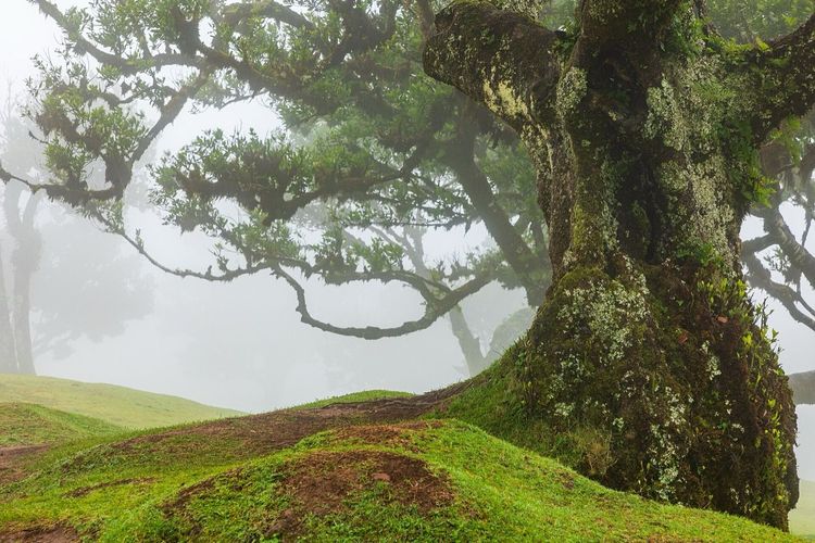
Fanal is a plateau at around 1,100m on the island's northwest shoulder, where centuries-old 'til' laurels stand alone in open pasture (the full story, new 2026 rules included, is in our Fanal deep-dive). Their trunks twist into shapes that look drawn rather than grown. This is the UNESCO laurisilva at its most photogenic, and it needs no hike at all: park at the forestry post and wander between the giants.
The full PR13 runs 10.8km across the Paul da Serra plateau, a gentle route where you'll cross moorland, heather tunnels and that famous grove. It's point-to-point, so either arrange a pickup, walk back the way you came or book it as a guided leg. Many drivers just do the grove, and nobody will judge you for it.
Here's the local secret played backwards: check the webcams and go when the weather looks BAD. Fog turns Fanal from a pleasant picnic spot into somewhere genuinely otherworldly, all silhouettes and dripping moss. Sunny Fanal is a park. Foggy Fanal is a fairy tale with cows.
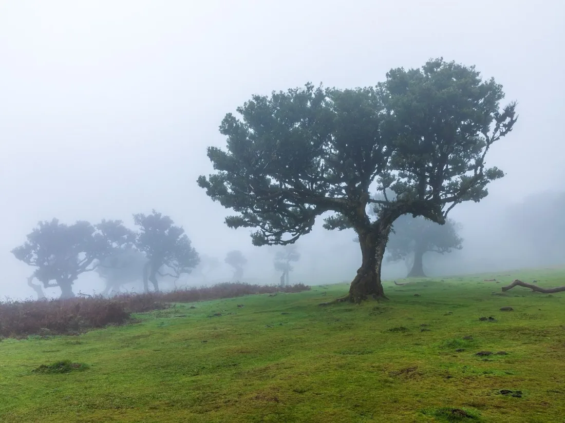
Photo: Dietmar Rabich, CC BY-SA 4.0 (Wikimedia Commons)
3. PR8 Vereda da Ponta de São Lourenço: the desert peninsula
8km out and back · 2.5 to 3 hours · moderate · Baía d'Abra, bus 113 from Funchal
The island's eastern tip plays by different rules: treeless and dry, striped in red and ochre rock, with the Atlantic working both sides of a narrow ridge. The PR8 walks the spine of it. You'll climb and drop over a series of saddles and pass basalt columns that geology teachers dream about. The viewpoints hang where the cliff falls a sheer hundred metres to surf on either hand.
It's a moderate trail with real accumulated climb, about 450m over the full out-and-back, and there's no shade anywhere. Carry water, wear a hat and skip the midday slots in summer. Near the far end sits Casa do Sardinha, a seasonal cafe in a grove of palms. Beyond it comes a final steep, gravelly pull up Pico do Furado for the view over the last wild islets. Legs already complaining? The cafe terrace is a perfectly honourable turnaround.
Logistics are friendly for once: it's an out-and-back and the car park at Baía d'Abra is decent. Bus 113 runs from Funchal for a few euros if you'd rather not drive. Book the €4.50 slot ahead on summer weekends, when this trail rivals the PR1 for demand.
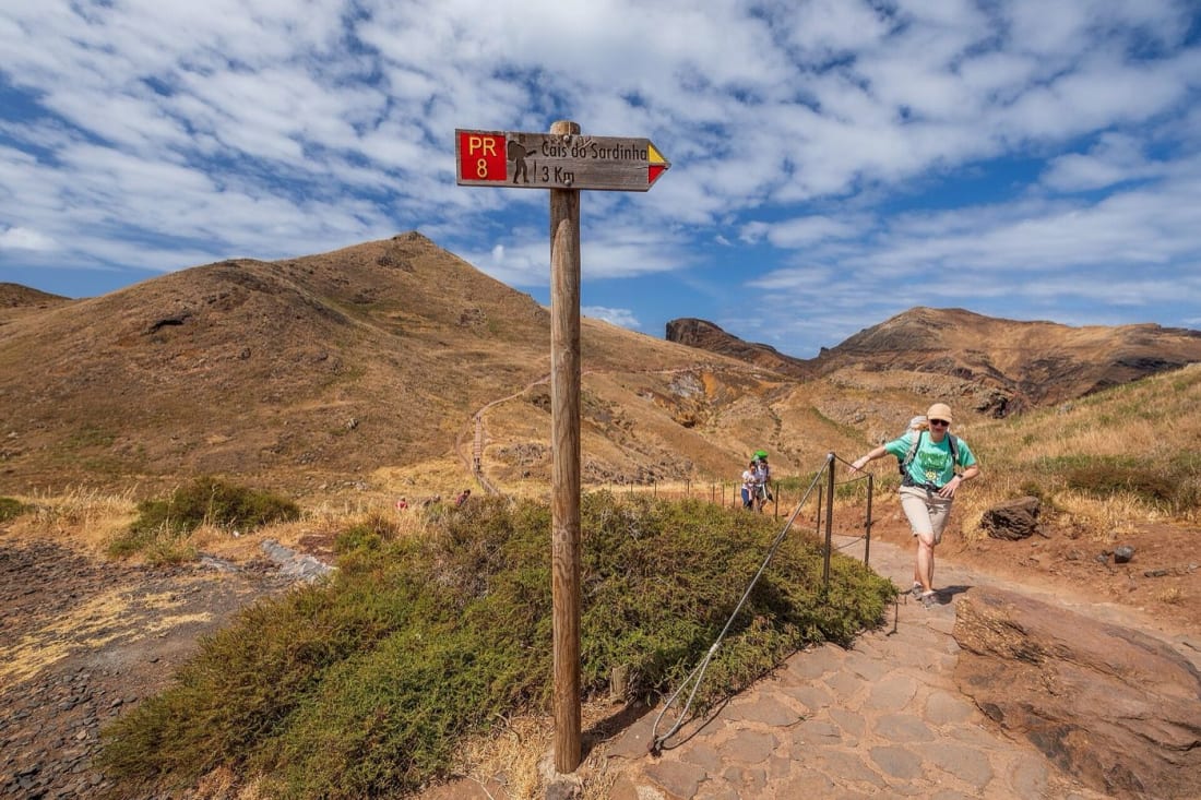
Photo: Ximonic (Simo Räsänen), CC BY-SA 4.0 (Wikimedia Commons)
4. PR6 Levada das 25 Fontes: the postcard levada
9km return · about 3 hours · moderate · Rabaçal car park (shuttle down to the trailhead)
Twenty-five springs seep out of a mossy rock wall into a green pool, and yes, it looks exactly like the photos. The PR6 follows the Levada das 25 Fontes from Rabaçal through tunnel-dense laurel forest, hugging the channel along ledges and under dripping overhangs. The valley finally opens at the lagoon. Pair it with the short detour to Risco, where a waterfall drops a sheer 100m down a black wall. That packs two of the island's signature water shows into one morning.
This is the busiest levada walk on Madeira, and the 2026 system actually improved it. A bypass section now runs one-way, which ended the two-way shuffle on a path the width of a garden shelf. Book the earliest slot you can get. By 11am the lagoon looks less like a sanctuary and more like a queue.
Since we're on levadas: they're a category of their own here, dozens of channel-side walks from pushchair-flat to properly airy. This guide sticks to the all-round best hikes. For the channel-by-channel breakdown, my colleague Inês wrote a dedicated guide to Madeira's levada walks, and it covers the ones this list leaves out.
5. Larano to Boca do Risco: the free coastal wildcard
About 10km return · 3 hours · moderate · Porto da Cruz side
Here's the route for the day your budget or your booking luck runs out. The old coastal path runs from the Larano area above Porto da Cruz to the Boca do Risco gap. It's not a classified PR trail, which means no fee, no slot and no gate. It also means you treat it with more respect, because maintenance is lighter and the drops are real.
The path contours the north coast on a green shelf between big water and bigger cliffs, with Penha d'Águia, the eagle rock, filling the view behind you. You'll cross a few narrow, exposed sections where the wire rope is there for a reason, so this one stays off the list for vertigo sufferers and small kids. On a clear day you can trace the coast to Porto Santo on the horizon.
Wind is the deciding factor here. The north coast catches weather the south never sees, and this path in a gale is no fun at all. Ask locally in Porto da Cruz, where the sugar-cane distillery and a black-sand beach make the after-walk plan easy.
6. PR9 Levada do Caldeirão Verde: tunnels to the green cauldron
13km return · 4.5 to 5 hours · moderate but long · Queimadas, above Santana
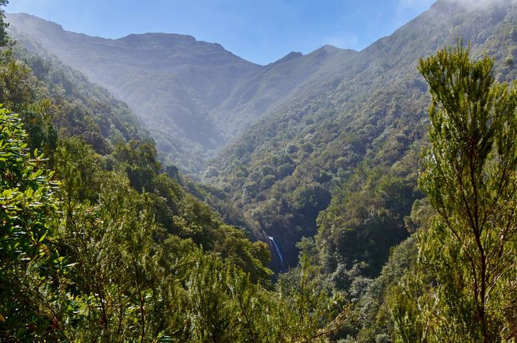
My home trail, and I'll defend it against any list that puts it below fourth place. From the thatched houses of Queimadas forest park above Santana, the levada runs dead level into the São Jorge valley, through laurisilva that has never been cut. It ducks in and out of four tunnels hacked by hand in the 1700s. The payoff is the 'caldeirão verde' itself: a mossy rock cauldron where a waterfall drops around 100m into a cold green pool.
Level doesn't mean effortless. Thirteen kilometres is a real distance, and the tunnels demand a head torch (one per person, and mind your head in the low one). The ledges past tunnel three hang over serious depth, with a fence between you and it. In return, you'll walk the most consistently gorgeous kilometres on this island. Queimadas sits far from the southern resorts, so the crowds thin fast beyond the second tunnel.
Fit and greedy? Continue up the extension to Caldeirão do Inferno, where stacked gorge walls close overhead. And on the drive out, Santana's restaurants do the north-coast standards properly, which matters after five hours on a levada ledge.
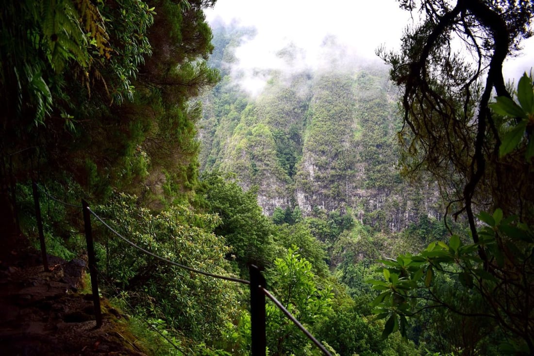
Photo: Sebastian from the EU, CC BY 2.0 (Wikimedia Commons)
7. PR1.2 Vereda do Pico Ruivo: the easy way to the roof
5.6km return · about 2 hours · moderate · Achada do Teixeira
Everyone should stand on Pico Ruivo (1,862m), the highest point of Madeira and the third-highest of all Portugal. Not everyone should have to earn it across the full ridge. The PR1.2 is the sensible route: from the road-end at Achada do Teixeira, a broad paved path climbs steadily for 2.8km to the summit shelter, then a final rocky ramp puts you on top of the island.
You'll gain about 300m of height, which is enough to feel it and little enough to bring a reasonably game grandparent. On the way up, the view swings from the Santana coast across the whole central massif, and heather trees frame the path like something staged. The shelter below the summit sells drinks when the shutters are open, and that's the extent of the services, so carry water anyway.
Two tips. First, this is the best sunset summit on Madeira, because the walk down is manageable by head torch, and the west lights up behind Pico do Arieiro. Second, book the afternoon slot even in shoulder season: since the trail shares its top station with PR1 finishers, the car park pulses in waves.
8. PR1 Pico do Arieiro to Pico Ruivo: the ridge everyone came for
7km one way, around 11km with the Achada do Teixeira exit · 4 to 5 hours · hard · €10.50, gated access
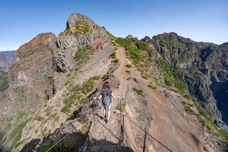
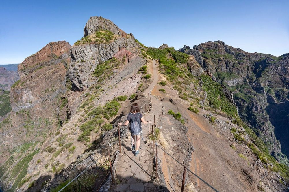
The road runs all the way up to Pico do Arieiro (1,818m), which sounds like cheating, and honestly, it is. The summit is only the doorstep. From there the PR1 traverses the spine of the island to Pico Ruivo (1,862m), on stone staircases cut into cliff faces in the 1960s and through hand-bored tunnels. The drops fall away for hundreds of metres beside a path two boots wide. Online it's nicknamed the 'Stairway to Heaven', and for once the internet undersells the thing.
This is the roof of Madeira: a ridge in the sky with the whole Atlantic for a horizon and nothing above you but weather.
The numbers deserve respect. It's 7km of trail one way, but you'll lose and regain around 1,000m of height along it. The return over the same staircases doubles the toll. Most hikers walk it one way in 4 to 5 hours and exit down the PR1.2 to Achada do Teixeira. That exit needs a plan: a pre-arranged transfer, a guided sunrise trip (the sunrise and sunset experiences mostly bundle the logistics) or a taxi that walkers report at €60 to 80 back around the mountain. Plan the exit before you plan the photos.
Book the earliest 30-minute window SIMplifica will sell you. Sunrise from the first kilometre, above a sea of cloud, is the single best moment this island offers. The gate stays locked outside official hours, so there's no freelancing an earlier start. Watch the forecast like a hawk: fog turns the ridge from spectacular to pointless in twenty minutes, and wind makes those staircases genuinely hostile. The direct 'variant' shortcut below Pico das Torres has spent long spells closed after rockfall, so assume the main line and its full staircase count.
9. Pico Grande from Boca da Corrida: the connoisseur's summit
About 10km return · 4 to 5 hours · hard · Boca da Corrida chapel, above Estreito de Câmara de Lobos
When the PR1 car park is a bus depot, this is where the quiet hikers go. From the chapel at Boca da Corrida, the old royal path (the 'caminho real') contours into the green bowl around Curral das Freiras. That's the valley where nuns once hid from pirates. Pico Grande (1,654m) stands ahead the whole way like a bass note. The final section climbs steep, rocky ground, with a short scramble to a summit block that sees a fraction of Ruivo's traffic.
Count on four to five hours round trip and pick a dry day, because the last stretch is no place for wet rock. In exchange you'll get the best mid-mountain views on Madeira. Terraced valleys sit a kilometre below, the full north ridge stands above, and usually nobody shares the top except kestrels.
There's no fee and no booking here, which increasingly makes it feel like the island as it was. Keep it that way: pack out everything, and leave the summit cairn alone.
Three more for a longer stay
A week gives you the nine above with rest days. Anything longer, and these three earn their slots. PR14 Levada dos Cedros drops from the Fanal plateau through old-growth laurisilva toward Ribeira da Janela, around 6km one way of the quietest forest walking on the island. PR18 Levada do Rei runs about 10km return from the water house at Quebradas near São Jorge, along what locals rate the greenest channel in the northeast. And PR12, the Caminho Real da Encumeada, crosses the mountains from Boca da Corrida to the Encumeada pass, roughly 12km of old royal road that sees a fraction of the ridge traffic.
None of the three needs a summit day's legs, and all three book on the same SIMplifica system for €4.50. They're also the smart bad-weather cards: forest and mid-mountain routes stay walkable on days when the high ridge is a wind tunnel.
Is Pico do Arieiro to Pico Ruivo open?
As of July 2026, yes: the PR1 traverse is open end to end and bookable on SIMplifica for €10.50 per person. The route reopened fully in spring 2026 after storm-damage repairs, with the new gated access and timed entry in place.
The picture around it moves constantly, and that's the real answer to memorise. The 'variant' shortcut under Pico das Torres closes after rockfall for long stretches. PR10 Ribeiro Frio to Portela was closed by landslide damage at the start of 2026. PR7 Levada do Moinho has been shut since 2024. Both still get warm recommendations from articles written before the closures. Check the official trail status list the night before every hike on this island, without exception. Closures come with little warning, and a locked gate after a 40-minute drive is a bad start to a good day.
What to wear and pack for Madeira's trails
Layers beat any single jacket, because you'll cross three climates in a day. Count on roughly 10C colder at 1,800m than in Funchal, plus wind chill on the ridges, plus tunnel drip on the levadas. My default kit for any of the nine hikes above: real hiking shoes with grip for wet stone, a fleece and a light waterproof. Add a litre of water per person, sunscreen for the coast and a head torch for tunnels or a late descent.
Poles help more here than on most islands, since Madeira's trails deal in staircases rather than gentle gradients, and your knees will file complaints on the PR1 descent. Phone coverage is decent on the classified network but patchy in the valleys, so download the maps offline. And check yourself for the classic visitor error: trainers with smooth soles on a wet levada ledge. Every season the rescue teams collect somebody who tried a mountain in flip-flops. Don't be that hiker.
Where to stay for a hiking trip
Funchal makes the easiest base: rental cars, the bus hubs, the tour pickups and the best food scene all live there. Everything on this list sits within about an hour's drive. If your week leans hard on the northeast trails, split the stay and spend nights in or near Santana. That puts Queimadas, Achada do Teixeira and the sunrise drive to Arieiro much closer than the south coast. For what to do between hikes in the capital, our Funchal guide covers the old town, the cable car and the market without the tourist-menu traps.
Wherever you sleep, hire a car with some engine in it. The island's roads climb like the trails do, and the difference between a 1.0 and a 1.4 litre shows on the way to Fanal.
Getting to the trailheads
A rental car remains the default, and honestly, book one with some engine in it, because the trailhead roads climb hard. Parking is easy everywhere except the two stars: Pico do Arieiro fills by 8am in summer, and the Rabaçal car park feeds 25 Fontes through a shuttle van down the access road. Leave earlier than feels reasonable.
Buses cover more than most visitors expect, at a few euros a ride. Bus 113 runs from Funchal toward Caniçal for the São Lourenço trailhead, and the Santana-bound services stop at Ribeiro Frio for Balcões. The catch is frequency: schedules thin out fast in the afternoon, so check the return times before you commit to a one-way walk.
For the awkward ones (Fanal with no bus at all, the PR1 exit problem, Achada do Teixeira after sunset) you're down to a taxi arranged in advance or a tour that bundles the transfer. On a first trip, mixing a rental car with one or two guided hiking days covers the whole list without a single logistics headache.
A one-week hiking plan that actually works
Here's how I'd stack it for a first visit, assuming a Funchal base and a rental car. Day one, land, sort the car and stretch your legs on Balcões, then book the week's SIMplifica slots over dinner, because you'll now know what the weather's doing. Day two, São Lourenço at 8am before the heat, with the afternoon on Caniçal's beaches. Day three is the big one: the PR1 traverse at sunrise, and you won't want anything harder than a pool afterwards.
Day four, drive the northwest: Fanal in the morning fog if you're lucky, the Porto Moniz lava pools after, and there's no shame in letting a 4x4 tour do the driving. Day five, the earliest 25 Fontes slot you managed to grab, which leaves the afternoon for Funchal's old town. Day six, Caldeirão Verde with lunch in Santana, and that's the day you'll understand why the north coast keeps its own fan club.
Day seven is the choose-your-ending day: Pico Grande if your knees still answer emails, Larano if you'd rather have sea views, or nothing at all, because 'poncha' doesn't drink itself. Swap days freely around the forecast. The itinerary that survives contact with Madeira's weather is the one with a movable rest day in it.
Beyond the trails
Madeira's outdoor menu doesn't stop at walking, and two add-ons pair especially well with a hiking week. The canyons that make the interior so dramatic to walk above are even better from the inside. Canyoning in Madeira runs from beginner-friendly slides to serious descents in the laurisilva, with wetsuits and ropes handled for you. And the levada network deserves at least one dedicated day beyond the 25 Fontes crowds, which brings you back to the levada guide for the quieter channels.
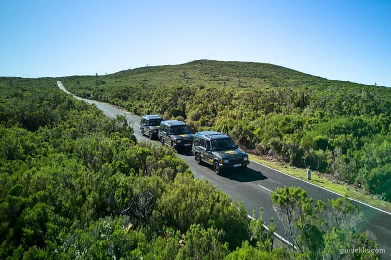
There's also a version of this island for people who want the views without the staircases. The 4x4 and jeep tours reach Fanal, Paul da Serra and the northern viewpoints on the old forest tracks. That's the honest recommendation for mixed groups where only half the party owns hiking shoes.
FAQ
Does Madeira have good hiking?
Madeira has some of the best hiking in Europe for an island its size. Its 57km of land pack 1,800m peaks, a UNESCO laurel forest and around 3,000km of walkable levada channels. The classified PR network is waymarked and maintained, so the quality-to-effort ratio stays high even on short visits.
Which is better, Pico do Arieiro or Pico Ruivo?
Pico do Arieiro (1,818m) wins for effort-free views, since the road reaches the summit and sunrise happens by the car park. Pico Ruivo (1,862m) is the higher and quieter summit, a 2-hour round trip from Achada do Teixeira. The real answer is the PR1 traverse that connects them.
What is the hardest hike in Madeira?
The hardest classified route is the full PR1 out-and-back between Pico do Arieiro and Pico Ruivo. It stacks up around 2,000m of accumulated climb over the staircases. Off the classified list, steep unofficial summits like Penha d'Águia pack more brutality into less distance.
What is the most beautiful hike in Madeira?
Most walkers give it to the PR1 ridge at sunrise, above a sea of cloud, and they're not wrong. My local vote goes to Caldeirão Verde on a drizzly day, when the laurel forest drips and the waterfall carries real weight. Beauty per effort, Balcões wins outright.
How long does the Pico do Arieiro to Pico Ruivo hike take?
Most hikers take 4 to 5 hours one way with the exit down to Achada do Teixeira, around 11km in total. Strong walkers do it faster, but the staircases punish optimistic estimates, and sunrise starts add photo time. Doubling back over the ridge makes it a 7 to 8 hour day.
What should I wear hiking in Madeira?
Real hiking shoes, layers and a light waterproof, whatever the forecast says in Funchal. The summits run about 10C colder than the coast, tunnels drip year round, and wet volcanic stone is slick. Add a head torch for the levada tunnels and any sunrise or sunset plan.
Where should I stay in Madeira for hiking?
Funchal works best for a first trip: central, connected and within an hour of every trailhead on this list. Dedicated walkers should add nights around Santana on the north coast, which shortens the drives to Queimadas, Achada do Teixeira and the central peaks.
Madeira is also one region of a country that hikes well everywhere: the hiking in Portugal guide maps the rest, from the Azores to the mainland's wild coast.
One last piece of local orthodoxy. A Madeira hike hasn't officially happened until it ends at a table, and the mountain valleys do this best. Down in Curral das Freiras after Pico Grande, order 'espetada' (beef skewers grilled on laurel sticks), 'bolo do caco' garlic bread and a cold Coral. Finish with the chestnut cake the valley is known for. You'll have earned every plate of it, and tomorrow's trail will feel closer than your knees suggest.